


Urban escape
What to bring:
Compiled by Ruiling Erica Zhang.

By Ruiling Erica Zhang
Feb. 10, 2011 3:48 a.m.


In Los Angeles, you barely have to make a choice between the wilderness and the city. Nestled within city limits, Runyon Canyon, Mt. Hollywood and Temescal Canyon lets you have the best of both worlds with mountain trails that offer expansive views overlooking all of Los Angeles.
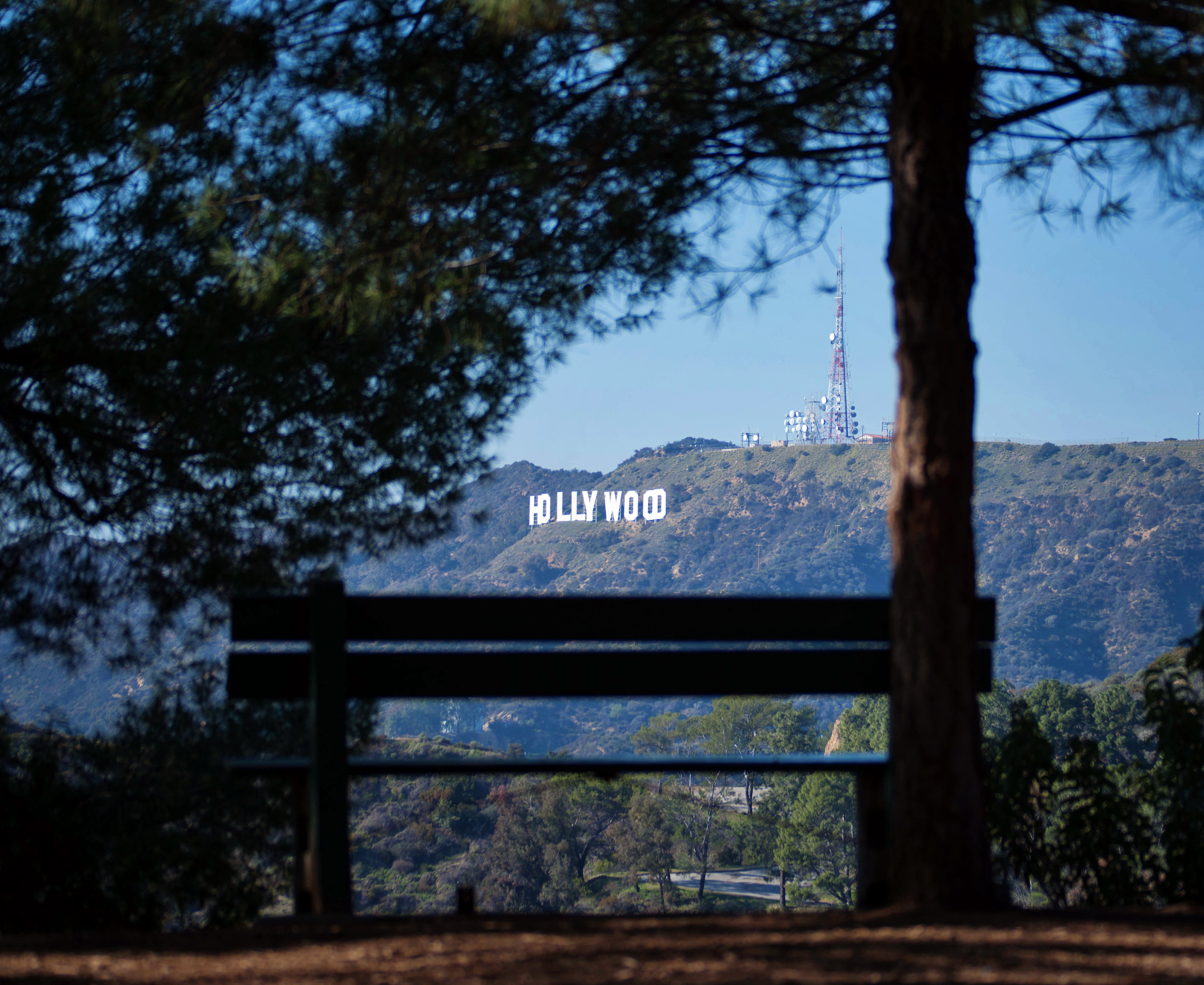
Runyon Canyon Loop, Runyon Canyon
Difficulty: easy
Duration: 1.5-2 hours
(Street parking on N. Fuller Avenue or nearby streets.)
What makes Runyon Canyon special is its location in the heart of the city, literally two blocks up from Hollywood Boulevard just before reaching Grauman’s Chinese Theater. The spot is popular with locals who live or work in the area.
Wide and well-worn fire roads make for a dog-friendly off-leash trail. At times the number of canine hikers seems to equal the number of their human counterparts.
The best time to arrive is in the afternoon around 4 p.m. This lets you get the most out of the fairly short trail with both a day and night hike experience. You’ll also be able to catch a stunning sunset.
Enter from the park entrance on Fuller Avenue and follow the main road on the right. As you walk, take a minute to appreciate the evergreens and palm trees that climb to impressive heights overhead.
Stay on the main road as it turns right, and you’ll soon approach a sign that points to an “observatory.” This point marks the beginning of a steep climb that constitutes the most strenuous part of the hike. Fear not, you will hardly notice the incline when you’re busy ooh-ing and ahh-ing over an already majestic view.
By the time you reach the observation point, you should be just in time for a spectacular show of nature’s own. You can watch the sun set behind Westwood in the distance and turn the sky a pink-red over the entire city.
Rest your feet here and sit on the comfortable high bench front-and-center that will give you the feeling of being on top of the world (the L.A. basin is massive enough for that effect). Watch the city lights begin to turn on. It won’t take long for night to fall, and when it does, the giant sea of tiny lights flickering in and out of focus is truly mesmerizing.
Savor the view for as long as you please and continue on the easy downhill main path that loops back to the entrance. A flashlight isn’t
necessary but helpful. Many will still be out on the trail at this time.
Mt. Hollywood, Griffith Park
Difficulty: easy to moderate
Duration: 2 hours or more
(Street parking all along side of the road leading up to the observatory.)
Mt. Hollywood is not to be confused with the Hollywood sign, which resides on Mt. Lee. The highest point in the city’s cherished Griffith Park, one of the largest urban wilderness parks in the U.S., Mt. Hollywood is the central peak north of the Griffith Observatory.
Begin the hike from the roadside following Charlie Turner Trail. For a more demanding hike, park lower down on the road and begin your hike at the base of the mountain ranges. This almost doubles the mileage traveled.
Wide and well-worn fire roads make for an easy trail surface. However, steep elevation gain in several passages make the hike more difficult.
As you make your way through Charlie Turner Trail to reach the central Mt. Hollywood, don’t forget to look around and take in the awe-inspiring expanse of Griffith Park. Sparse evergreen vegetation dominates the landscape. You’ll see the observatory to the south and the Hollywood sign to the west.
The trail ascends by veering left then right, until it reaches a trail intersection. Turn left at the crossroads to continue up to the summit.
On your way up, don’t miss tourist-photo opportunities. There’s a spot where you can take a photograph of the Hollywood sign with some conspicuous palm trees in front of it. Whip out some shades and say “cheese.”
There’s a clearing at the summit and a green pole to signify you’ve made it. Triumphant hikers put a hand on the pole or walk around it to congratulate themselves. In addition to a complete view of the city, you’ll see Burbank to the north and the lush green patch of Rancho Palos Verdes to the south.
To return, you’ll have to take the same way down. Be sure to stop at the observatory on your way back and learn all about the planets and the universe.
Like Runyon Canyon, Mt. Hollywood is accessible after dark. However, be sure to bring a flashlight and a map if you plan on tackling any part of Griffith Park at night, as there are numerous trail splits in the park.
Temescal Canyon Loop, Temescal Canyon
Difficulty: moderate to challenging
Duration: 2.5 hours
(Street parking on Temescal Canyon Road left off Sunset / $7 to park inside)
It’s no surprise that Temescal Canyon is a favorite among locals. Situated in beautiful Pacific Palisades near the coast, Temescal Canyon offers a view of the ocean that’s spectacular on clear days.
After entering the park, keep to the right on the paved road until you reach the narrow dirt path of Temescal Canyon Trail. This eventually connects with Temescal Ridge Trail to make a loop.
(For a more strenuous hike, reverse directions and enter on Temescal Ridge Trail to the left, marked by a few wooden steps. This direction makes a steep 1000-feet elevation gain in the first mile.)
The canyon is densely wooded with diverse vegetation. A small creek runs alongside the trail. As you climb your way up and deeper into the canyon, you’ll begin to hear the small waterfall at its source.
You will reach the waterfall and a little bridge about a mile into the trail. Depending on the season, you can even climb on the rocks below the waterfall.
From the bridge, another mile or so up the rugged trail will bring you to the highest points along the ridge. Here the vegetation consists mostly of shrubs and other shorter plants that open up the trail for views of wealthy neighborhoods to the west and the ocean to the south. The furthermost point on the ridge offers a complete view of the coastline, as well as the rest of the city. Chances are you’ll catch sight of sailing boats on the horizon.
The remaining two miles down Temescal Ridge Trail to complete the loop is quite steep. You’ll find yourself unwittingly running down some stretches of it. The trail surface is well-worn and smoother than the uphill trail, so good footwear is a must.
As you make your descent, take advantage of your elevation and be sure to spot the trailhead and Temescal Canyon Road where you parked. Don’t despair, it’s not as far as it looks! The exceptional scenery and quiet seclusion in the canyon make this a hike you’ll want to revisit again.
Temescal Canyon Loop is accessible from sunrise to sundown.

