


The pLAces you’ll go: Temescal Canyon
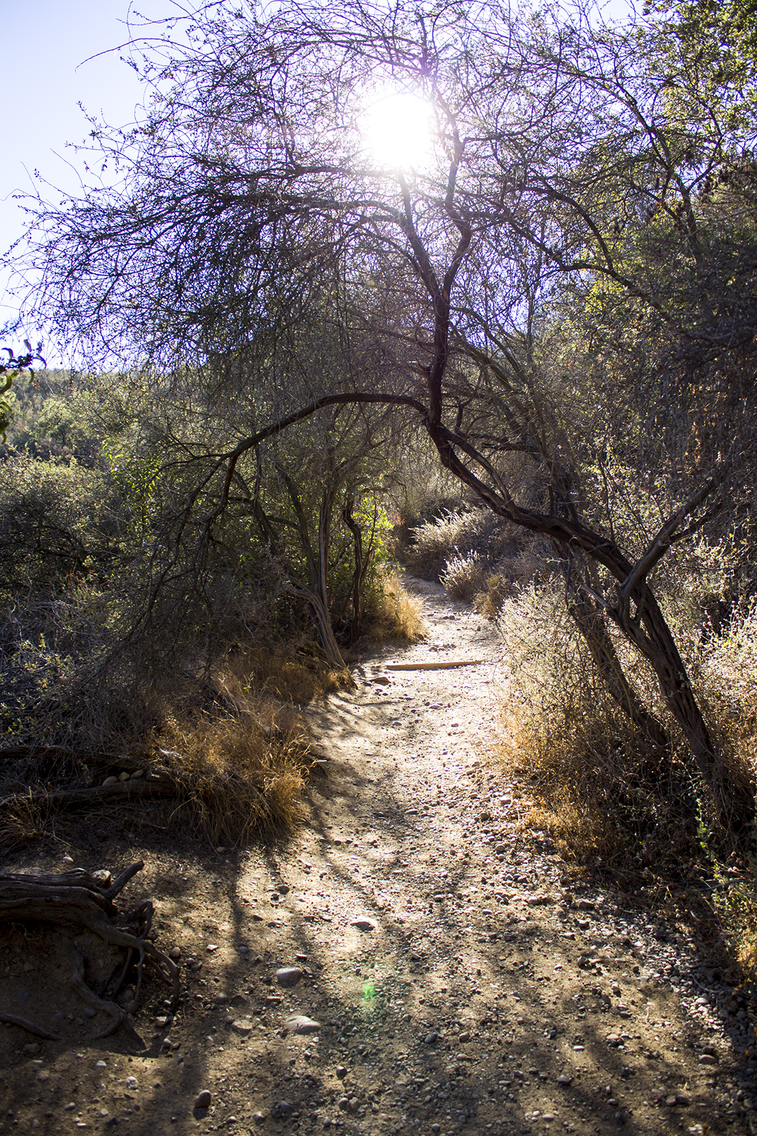
Temescal Canyon provides Angelenos with comfortable hikes of the Chaparral Hills, featuring skyline views of Los Angles and the Pacific Ocean.
(Alyssa Dorn/Daily Bruin)

By Maryrose Kulick
Nov. 14, 2014 12:34 a.m.
There are more than 500 square miles of city surrounding UCLA’s campus, which takes up a minuscule fraction of that mileage. For such a big place, Los Angeles at times seems impossible to navigate. But don’t let size steer you away from your sense of adventure and curiosity. Each week this quarter, follow columnist Maryrose Kulick as she takes you to a new and affordable L.A. destination, to help you explore the city you call home.
One hiking boot after another, I climbed my way up the mountain, breathing heavily. Each time I looked back at my progress, a little more of the city revealed itself from behind the Chaparral Hills. By the time I reached the top, Los Angeles and the entire Pacific Ocean were practically bowing at my feet.
When many think of the ideal weekend getaway in the L.A. area, the prominent images that come to mind are typically sandy beaches and cool ocean breezes. But Los Angeles is also home to a spectacular mountain landscape that offers some stellar hikes and amazing views for those of an adventurous spirit.
My first hiking trip in the Santa Monica Mountains was in Temescal Canyon, an easy 20-30 minute bus ride away from UCLA via Sunset Boulevard. With a backpack full of water, a sandwich from Bruin Café and two companions by my side, I was ready to hit the trail.
There are many different options as far as routing goes in hiking the Temescal trails, with many trails that branch off the main routes itching for exploration. For this trip, our goal was to complete the Temescal Canyon Loop trail with an extension to Skull Rock.

There are two options when embarking on this journey – you can either start with the Temescal Canyon Loop or the Temescal Ridge Trail, each a little over a mile long. The Ridge Trail, however, I found to be quite a bit steeper relative to the alternative starting point.
We ended up choosing to begin with the more gradual Canyon Loop, which admittedly was a little difficult to find, as there weren’t many signs to lead us in the right direction. There were, however, maps in the parking lot and plenty of nice people either employed by the park or simply walking their dogs who were happy to point us on our way.
Once on the trail, we walked along a dried up riverbed that slowly increased in depth as we hiked our way up the canyon ridge. I was soon surrounded by hills and nature, walking past the occasional budding wildflower and tall prickly cactus. It was almost difficult to imagine at this point that just 30 minutes before I had been riding public transit in one of the largest cities in the world.
Moving further up the trail, we reached the Temescal Waterfall, a popular highlight of the trail. Although, right now its proper name should be the Temescal puddle – thanks a lot, California drought. It was still a lovely area to cool down, climb on some boulders or, like the children playing in the puddle, take samples of some macroinvertebrates.

(Maryrose Kulick/Daily Bruin)
After feigning some awe and wonder at the trickle of a waterfall, we moved across the bridge to the other side of the canyon, where we began to make our ascent to the top of the ridge and found the junction between the Ridge Trail and Canyon Loop. But instead of finishing the loop, we took a right on a third trail and made our way to Skull Rock.
Along the path, the views of the Pacific Ocean and the city were spectacular, and I can only imagine how great they would be on a less hazy day – but the path views really couldn’t amount to the ones atop Skull Rock.
Soon enough, we came to see large orange rocks protruding out of the mountain, one that was particularly shaped like a head, hence the name “Skull,” I suppose. Adjacent to Skull Rock was another large rock with an easy path for climbing, and I was able to sit right on the top. I would have stood up, if not for my history of clumsiness. But from my perch on the rock, I could see practically all of Los Angeles and miles of the sunlit Pacific Ocean. I didn’t feel so out of reach from home, then, seeing the world below me.
Our final descent down the mountain was along the Ridge Trail, where the ocean still never ceased to amaze until it finally disappeared behind the hills.
Once out of the wilderness and back on Sunset Boulevard, our total trek amounted to about 4.6 miles – a moderate distance, perfectly doable for UCLA students used to hiking the hills to and from classes.
If you’re itching for an environment wilder than the concrete jungle that is Los Angeles, take to the trails on your next weekend excursion. Get some exercise and breathe the fresh mountain air. But don’t stop at Temescal Canyon – research your own hikes. The Santa Monica Mountains and more are full of expeditions waiting to happen.


